Fix Dead End Paths: The Tragedy of the Definitive Map
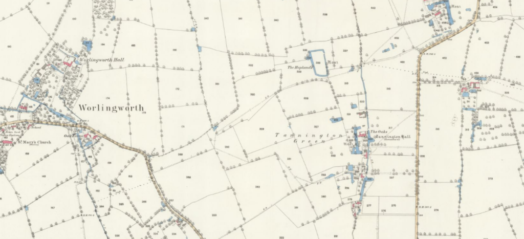
A number of dead-end footpaths in Worlingworth, Suffolk including a path which starts and stops in the middle of nowhere at the parish boundaries. The definitive map was undoubtably the savour of our rights of way network. Without it, many paths would be been lost. Indeed, having done extensive research the Victorians were adept at […]
English & Welsh Rights of Way Statistics
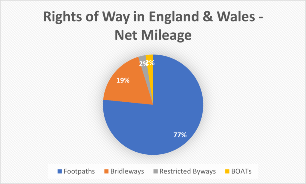
I have complied all, currently available, rights of way maps for England and Wales using data from Barry Cornelius (rowmaps.com). With the merged datasets, I have complied a set of essential statistics for Rights of Way in the UK. Any region which is not support on this site will, naturally, not be included in the statistics below. Though the regions we do not currently cover tend to be small in nature, please bear this in mind. Nonetheless, the statistics below paint a useful broad picture of the state of rights of way in the UK. We have included a download link to the appropriate combined dataset below. Please feel free to share this page, any data and any images or charts – everything on this page is released under CC0 (Public Domain).
The Deadline Has Been Scrapped!
A wonderful festive gift: the deadline to register lost rights of way has gone!
This is delightful news – indeed many paths will be hundreds and hundreds of years old so the deadline was always going to be a heritage destroying policy. It was introduced under Blair who did some fantastic work implementing right to roam and sorting out the ‘Roads used as Public Paths [RUPP]’ issues. Originally set to 2026, it has been continually paused and pushed eventually settling on 2031 during the last Conservative government.